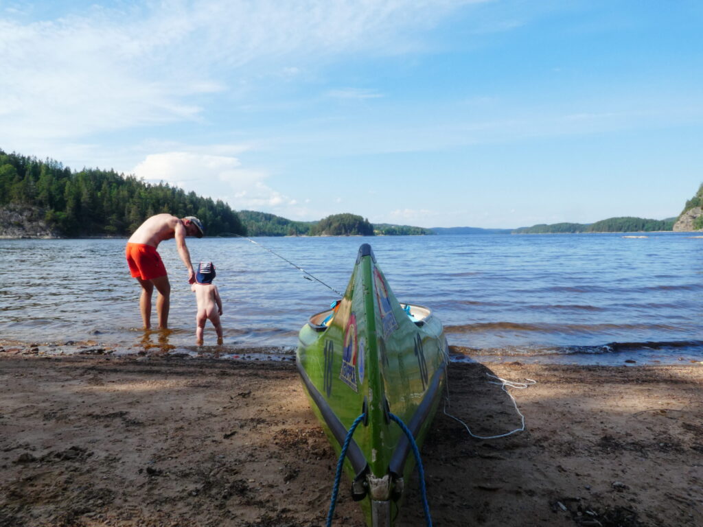
Adventure is Just a Trail Away
Brålands Gård boarders to a nature reserve and everybody who comes here is surprised over the wild and absolutely stunning and powerful nature. There is a 1 km long trail along the river which connects to the famous Bohusleden. Bohusleden reaches all the way from south of Gothenburg to Strömstad, just before the boarder to Norway. The trail is divided into 27 day´s march and number 16 Kaserna to Harska is connected to Brålands Gård. There are lots of other trail in the are like Kuststigen and more, se the links below to find out more.
Plan your hike along:
Maltes stig – 4 km by the fjord av Gullmarn, start here
Exercise trails for running, skiing, and cycling – find here
Kynnefjäll – Sweden’s southernmost mountain, only 10 kilometers from the farm – find here
Bohusleden Stage 16: Kaserna – Borgmästarbruket
Welcome to Bohusleden, a 27-stage trail covering approximately 340 km of beautiful and varied nature in Bohuslän. The trail stretches from Lindome in the south to Strömstad in the north.
Stage 16 of Bohusleden takes you through a scenic journey in Munkedal, offering flowing rivers, rocky shores, and lush forests. A perfect blend of nature and history, this stage provides a rich hiking experience just minutes away from the town yet still immersed in the wild beauty of Bohuslän.
Starting at the Kaserna Canoe Center, the trail follows Munkedalsälven and Örekilsälven, two stunning rivers that are home to beavers, kingfishers, and Atlantic salmon. Along the way, you’ll pass historic dams built for Munkedal’s paper mill, where the beavers thrive, and possibly spot them building their impressive dams from branches and mud.
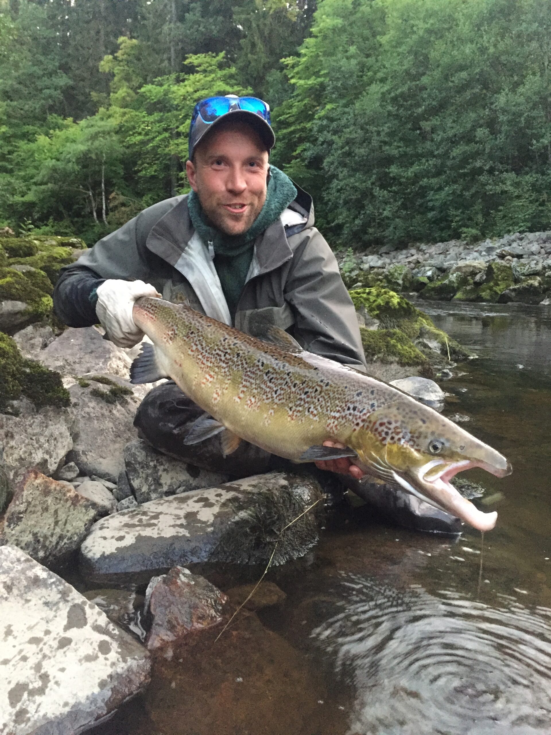
Örekilsälven, Bohuslän’s second-largest river, is a prime location for salmon fishing from May to September, and its banks are home to a variety of bird species like the dipper and the wagtail. Don’t miss Brålandsfallet, the largest waterfall in Örekilsälven, where fish ladders have been built to help salmon reach Kärnsjön.
The trail also offers interesting detours:
- Kaserna: Visit the childhood home of author Pontus Wikner, now a local heritage site.
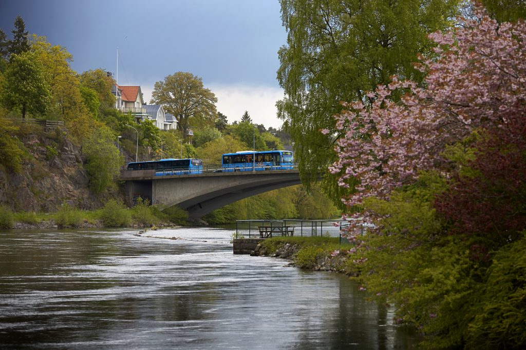
- Munkedal Town: A short detour (2.5 km) to the town center, where you’ll find public transport, supplies, and local attractions, including Munkedals Herrgård and a historic stone bridge.
End your hike at Borgmästarbruket, a preserved industrial site with sawmills, mills, and homes, offering a glimpse into Munkedal’s early industrial history. Take a moment to enjoy a packed lunch by the river.
Length & Difficulty: 6 km, moderate
Surface: Forest path and asphalt
Time: 2-3 hours
Read more about Bohusleden Stage 16 Kaserna – Borgmästarbruket
Read more about Bohusleden here
Read more about Bohudsleden Stage 15 Metsjö – Kasernna
Read more about Bohusleden Stage 17 Borgmästarbruket – Kyrkoryr
Read more about hiking trails in West Sweden here

Brålandsfallet med laxtrappa - Bohusleden etapp 16
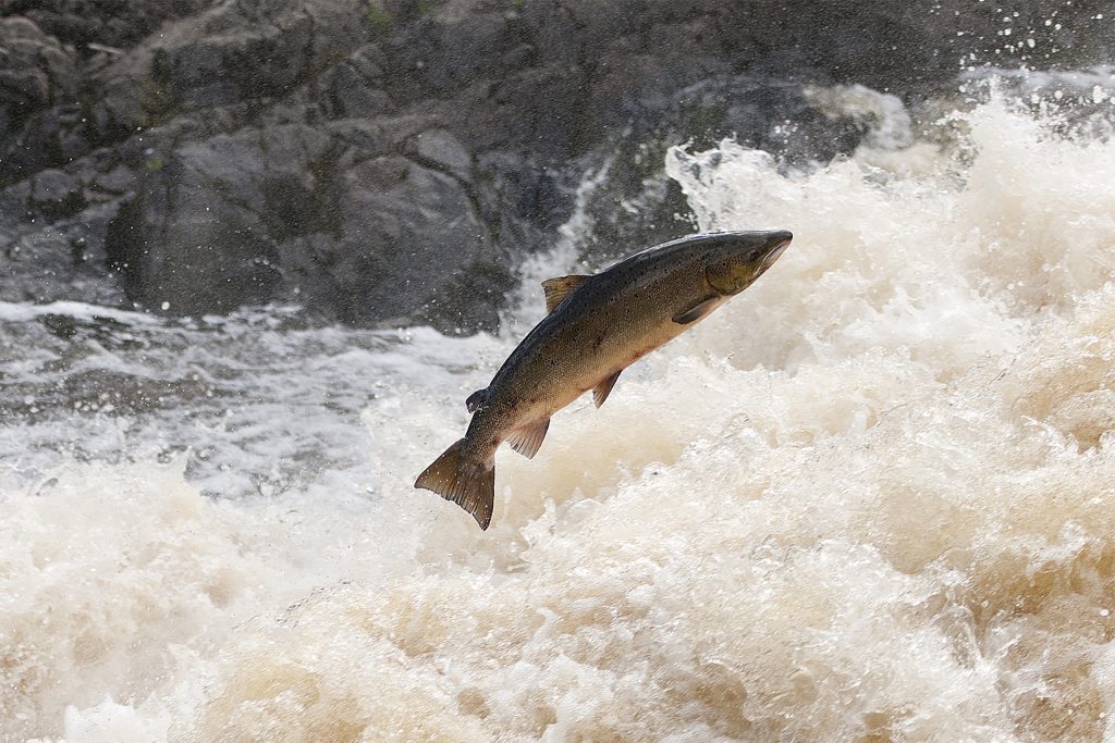
Wild Atlantic salmon jumping in Brålandsfallet, Örekilsälven. Photographer: Ingemar Pettersson
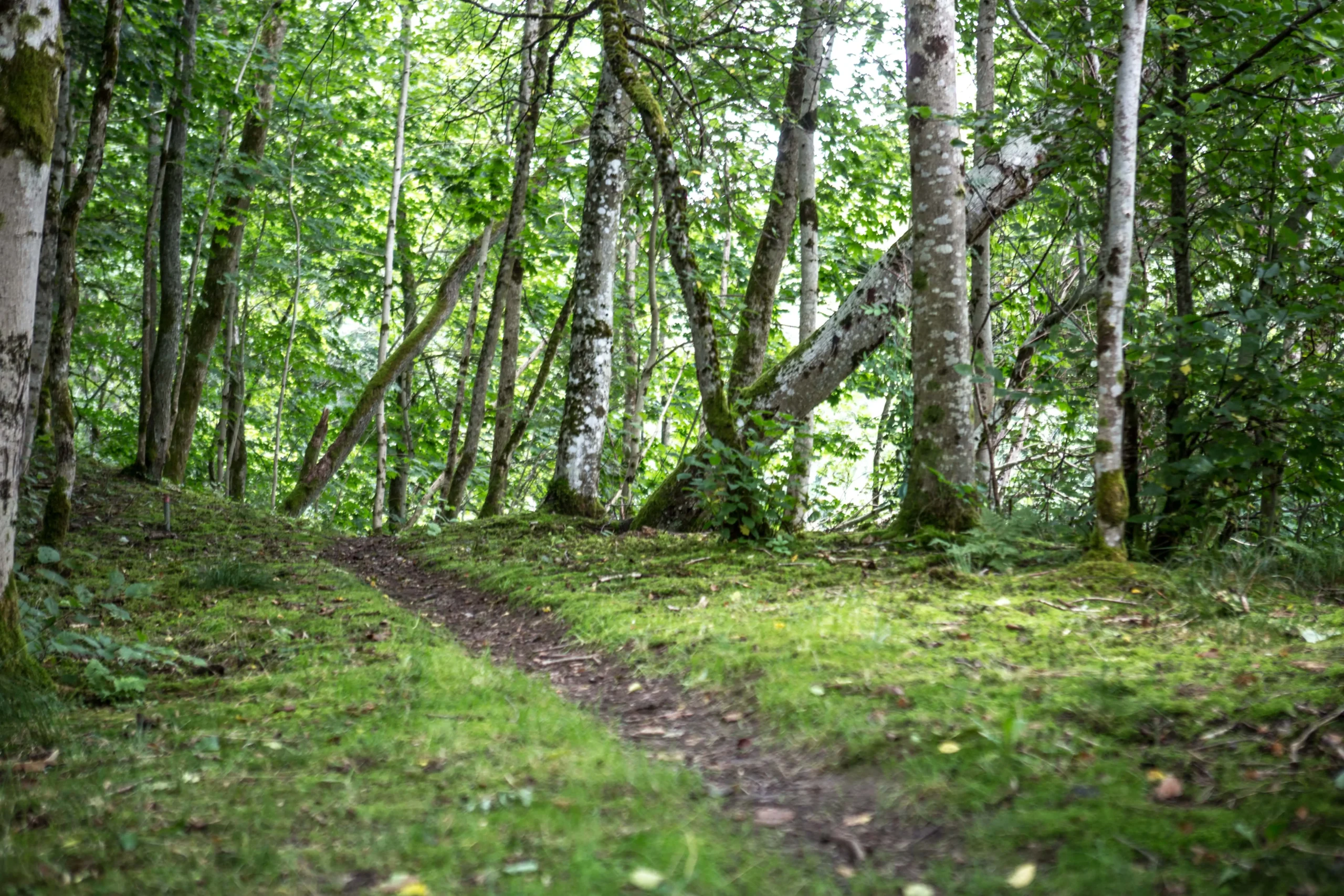
Explore Brålands Gård’s 6 scenic loop trail
Loop trails with starting point and finish at Brålands Gård.
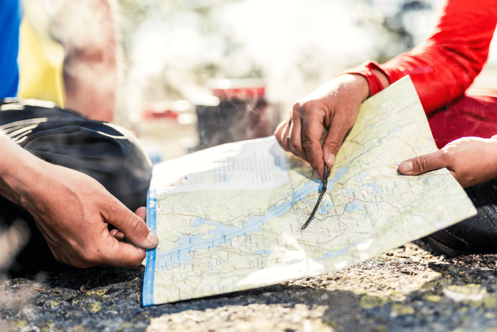
You will receive maps of the recommended hikes upon arrival. Here’s a brief description:
- Brålandsfalllet – Waterfall & Salmon Ladder
Follow the trail upstream along the Örekilsälven to Brålandsfallet. Go up the hill and walk through the cultural landscape home. Approximately 1 hour with a chance to see jumping wild Atlantic salmon.
2. The Salmon Trail
Follow the trail upstream along the Örekilsälven to Brålandsfallet. Cross the waterfall via the bridge and continue on Bohusleden, stage 16, heading south. Turn right down the hill to follow Munkedalsälven river until it meets Örekilsälven. Walk upstream along Örekilsälven back to Fura and Brålands Gård. Approximately 6 km.
3. Borgmästarbruket
Follow the trail upstream along Örekilsälven to Brålandsfallet. Continue on Bohusleden, stage 16, to Borgmästarbruket and then turn back to the farm by walking up to the road. Walk through the cultural landscape, via Smedbergskrysset and over Öbbon’s hills, and return to Brålands Gård. Approximately 3 hours.
4. Kärnsjön
Follow the trail upstream along Örekilsälven to Brålandsfallet. Continue on Bohusleden, stage 16, to Borgmästarbruket. Connect to Bohusleden, stage 17, and continue up to Kärnsjön. When the trail turns onto a gravel road, take it back over Torps Herrgård and enjoy the cultural landscape. Return via Smedbergskrysset and Öbbon’s Kulla back to Brålands Gård. Approximately 4 hours.
5. Härska Wind-shelter
Follow the trail upstream along Örekilsälven to Brålandsfallet. Continue on Bohusleden, stage 16, to Borgmästarbruket. Connect to Bohusleden, stage 17, and continue up to Härska wind shelter. On the way back, continue on the gravel road over Torps Herrgård and enjoy the cultural landscape. Return via Smedbergskrysset and Öbbon’s Kulla back to Brålands Gård. Full-day hike for the experienced hiker.
6. Strömarnas Nature Reserve
Follow the trail upstream along the Örekilsälven to Brålandsfallet. Cross the waterfall via the bridge and continue on Bohusleden, stage 16, heading south. Continue to Kaserna, where you connect to Bohusleden, stage 15, continue to Modalen Stugan, where you turn off and cross Munkedalsälven by raft. Hike back along the opposite side to Kaserna and head back on Bohusleden, stage 16. Continue down the hill and return via The Salmon Trail. Full-day hike for the experienced hiker. A shorter version is to start at Kaserna, approximately 10 minutes by car or bus from the farm.
Accessible by public transport
Only 1.5 hours from Gothenburg to Brålands Gård – plan your trip here.
The nearest bus stop is Uddarne (1.2 km away), but you can also contact local transport services to book a ride directly to the farm, avoiding the last kilometer walk. On-demand bus service: Local Services Munkedal.
You can also hike along the river from the train station. Walk through the town center to this point: 58.474749, 11.675560
Alternatively, view directions on Google Maps here.
Follow the trail upstream along the Örekil River to Fura where you’ll find stairs leading up to the farm. Coordinates to Fura: 58.486176, 11.677176
Make a Booking Request
You may also like…